


Project name: Collective Housing Planning for Landless People in Chumporn
Funder/Sponsor: CODI
Collaborators: CODI; Agricultural Land Reform Department
Year: 2021
Project type: COMMUNITY DESIGN; SUSTAINABILITY; COMMUNITY DEVELOPMENT; HOUSING DESIGN; ECO-COMMUNITY BUILDING
Background
The Collective Housing in Chumporn Project is part of CODI’s rural housing project that started six years ago. More than 65% of farmers in Thailand are landless, about eight to ten million families. Housing these farmers has become a priority for the Thai government.
Openspace came in one and a half years ago to collaborate with the Agricultural Land Reform Department and the local government under the Agricultural Ministry.
The main challenges for this project were:
The concept of participation – how can people engage with the project and create a new community?
Internal planning and design – since this area borders one of the main forests in Thailand, there needs to be a lot of thought about connecting the project with ecology and sustainability.
An upside down working progress
This project involved a lot of research from the team at Openspace. Our involvement started just before the beginning of the COVID-19 pandemic; as we result, we didn’t get to visit the site and meet the community as we would normally do.
We are experienced working with people on the ground with a bottom-up approach, so this process has been quite different. We have been working closely with the community that moved on the land in phase one and CODI, and got advice on the context and important conditions from the Agriculture Land Reform Department team, as well as closely analysing the site from our first two visits before lockdown.
This is a pilot project to test how we can use participatory people’s process on the land owned by the Agricultural Land Reform Department. Our approach to working with people is different to that of the Department’s. They select beneficiaries by lottery. What is missing is the intention to create a community, that wants to resettle together. For this project, we focus on principles on the principles of creating an eco-community, so people’s intentions are really important.

Rural planning for landless people: Site visit

The site
The site is in Chumporn province, in central Thailand. The area receives lots of rainfall, while there are also wind and storms. It’s influenced by South-West and North-East monsoons, with more than eight months of rainfall per year. There is also a high risk of tropical cyclones and typhoons. In 1989, Typhoon Gay, also known as the Kavali Cyclone, hit the area, causing major damages. This is an important consideration to make in the design of the community.
The site is a mid-sized, low, wave-like mountainous area, with slopes of 2-35%. It is considered good agricultural land, and has also forest and mountain areas. It used to be a rainforest, that was then turned into a palm tree plantation from 1979 until around 2016. The soil has therefore been depleted; it is now dry and in need to revival.

Rural planning for landless people: Dry and depleted soil after 36 years as a plan tree plantation
The area that we are working on covers 6,281 Rais (~2,482 acres) – it’s a whole mountain! The community is named after the plot number – no. 0083 Hongcharoen Community. A total of 830 families will be moved into the area.
Moving on from phase one
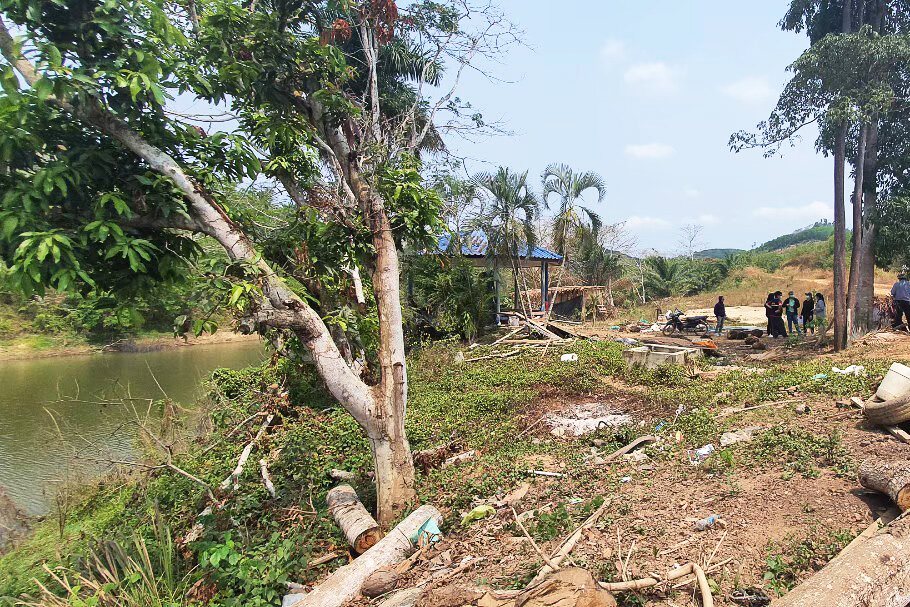
When we got involved, the first phase – 105 families – had already started building their houses. The rest of the land was still palm trees, with other areas being demolished to create empty land.

Phase One: The first families are building their houses
Looking at phase one, we found that there were a few problems with how the land was divided into 105 plots. In particular, we had five main concerns:
Plots are divided with no concern for waterways, or high/low land for particular land uses
There is no community level programmes or spaces planned for community building– no cluster level programmes. The only provisions are for the whole plot
No planning for forest use or as part of building sustainable ecological systems
The infrastructure is conflicting with how land plots are divided between the people and the forest. The streets cut through forest areas and waterways.
There are no particular rules in terms of land use for all land divisions. There should be some planning as to which functions are allowed in each plot, particularly depending on proximity to waterways and the forest.
Learning from the site
Since we had no people to work with, we started with a site study. We studied the physical slopes of the land to define the design of the community. We also looked at proximity to sea level. The highest part of the land was defined as a protected forest, to encourage the whole area to be more sustainable – both now and in the future.
Other areas were defined as usable forest areas, land plots, and protected upstream and downstream areas for future sustainable conditions. Our plan is going to reduce the number of land plots as there are both more forest areas and more protected lands.
We also divided the area into seven zones. This is to emphasise the necessity to build the settlement in a small group system. That way there is a social structure to support the community.
In each zone, we have a much smaller group of people to work with. Each zone has 85 to 100 families so the scale is much smaller.
We can have a closer social activity area, for people to gather and meet each other.

A community plan for Chumporn: The seven zones
Reviving the area
We proposed the idea of having buffer zones between the forest and waterways, and other activities – including agricultural lands, which didn’t exist in the first plan. This is where we try to introduce endemic plants. These are important to revive the quality of the soil and the water. The waterway is on the side of the buffer, and the farmland is on the other side. We put in a combination of different trees – high trees, canopy level, mid-level, ground level and riverbank plants that will enrich the soil and prevent erosion.

Planning buffer zones between the forest, the waterways and other activities
The area is located near important conservation areas and mountain ranges. So, clearly, it has the potential to invite lots of abundance from living things to come revive the area. We have plans for wildlife corridors along waterways, and people’s land plots.
Planning the land plots
We then showed how each family could deal with their land plot. Each plot is five rai – which corresponds to one family.
We propose that:
We should work with the right type of plants – including endemic plants
We should have a buffer between the protected areas and the farmland; or between the waterway and the farmland. The buffer would be a usable forest. The buffer would also produce abundance for the rest of the land. It could use permaculture principles.
We think that a waste management plan at house scale would be really interesting. That would include a small pond to treat the water.
There is an area for long term plants and trees, and then another area for fast growing farm plants.
Lastly, there is an area for the settlement and house.
Compromising and reaching agreement
While we were working on our plan, so was the Agricultural Land Reform Department. Their second plan conflicted with our work so we visited the site together to find a way to combine the two plans.

Combining the two plans
We agree on lots of aspects. However, we feel that the Agricultural Land Reform Department’s new plan still lacked details and some of the big picture principles that we proposed.
Our latest recommendations to the Agricultural Land Reform Department are:
We need to have community engagement areas at different levels
We need to plan wildlife corridors across the area
We need to have design different types of forest, with well-defined uses. In particular, there should be a clear distinction between usable and protected forests
We need to plan buffers for the waterways, and create underground water banks
We need to have a sustainable plan for five rai plot. Each plot needs to be discussed with people once they become involved in the process; but we need a good plan in place, that they can use to adapt to their family’s needs
We need to prepare a safe space to accommodate people in case of a disaster
We need to plan for the setback between the High Voltage electrical columns and people’s homes
We need to have community rules at different levels from community cluster level, zone level, and the whole 0083 plot level
We need to have garbage segregation systems, both at community and at city levels
We need to work together to define new rules/standards for this pilot community to ensure that this will be a sustainable community for now and in the next 50-100 years that works well for people, for the environment and for the whole city of Chumporn
Combining the two plans
Looking at the two plans together, we found three areas that we wanted to push forward.
1. Collective agricultural field
We would like to keep the existing boundary for agricultural land, while also creating a buffer for forest areas and waterways. The buffers are essential to protect nature and the sustainability of the whole area.
2. Community engagement spaces
We insist on having different levels of community spaces.
We would like to add more social spaces at community cluster and zone level to support long-term sustainable community living conditions. They can keep the boundaries they already have and add the programs.
3. Forest areas
We need to define and make sure there is a distinction between protected and usable forests. That allows us to have upstream forests, downstream forests, and have enough space to invite wildlife to return and support the community long term.

This project is ongoing.


